Ontario's Historical Plaques
at ontarioplaques.com
Learn a little Ontario history as told through its plaques
The Brent Crater
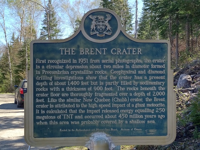
Photo by contributor K'an - Posted August, 2004
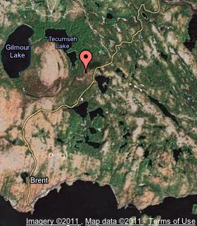
Plaque Location
The District of Nipissing
The Township of Papineau-Cameron
At the lookout tower on the eastern rim of the crater on Brent Road
32 km south of Highway 17
2 km east of Ferry Lane in Deux-Rivières on Highway 17
Coordinates: N 46 04.243 W 78 27.655 |
 |
Plaque Text
First recognized in 1951 from aerial photographs, the crater is a circular depression about 3 km in diameter formed in Precambrian crystalline rocks. Geophysical and diamond drilling investigations show that the crater has a present depth of about 427 metres but is partly filled by sedimentary rocks with a thickness of 274 metres. The rocks beneath the crater floor are thoroughly fragmented over a depth of 610 metres. Like the similar New Quebec (Chubb) crater, the Brent crater is attributed to the high speed impact of a giant meteorite. It is calculated that the impact released energy equaling 250 megatons of TNT and occurred about 450 million years ago when this area was probably covered by a shallow sea.
Related Ontario plaque
The Holleford Crater
More
Information
More
Landforms
Here are the visitors' comments for this page.
Posted February 1, 2011
K'an here. Happy to see my contribution still online! I'd just like to remind anyone who wants to visit this location in summer months: Mosquitoes are aggressive and abundant. Do NOT forget your bug juice. (I did.)
Here's where you can write a comment for this page.
Note: If you wish to ask me a question, please use the email link in the menu.
Note: Comments are moderated. Yours will appear on this page within 24 hours
(usually much sooner).