Here's where you can learn a little Ontario history
Founding of Simcoe
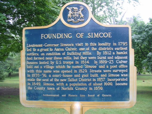
Photo by Alan L Brown - August, 2004
Plaque Location
The County of Norfolk
In Simcoe, at the north end of a park near the river, on the east side of Norfolk Street across from Union Street.
Look for the green arrow on the interactive map below.
Latitude and Longitude Coordinates
42.840100 -80.304200
Plaque Text
Lieutenant-Governor Simcoe's visit to this locality in 1795 led to a grant to Aaron Culver, one of the districts earliest settlers, on condition of building mills. By 1812 a hamlet had formed near these mills, but they were burnt and adjacent houses looted by U.S. troops in 1814. In 1819-23 Culver laid out a village which he named "Simcoe" and a post office with this name was opened in 1829. Streets were surveyed in 1835-36, a court-house and gaol built, and Simcoe was made the seat of the new Talbot District in 1837. Incorporated in 1849, Simcoe, with a population of about 1600, became the County town of Norfolk County in 1850.
Here's More
Information
Here's more pages about
Settlements
Here are the comments for this page.
(none yet)
Here's where you can write a comment for this page.
Note: If you wish to ask me a question, please use the email link in the menu.
Note: Comments are moderated. Yours will appear on this page within 24 hours
(usually much sooner).