Ontario's Historical Plaques
at ontarioplaques.com
Learn a little Ontario history as told through its plaques
The Long Point Settlement
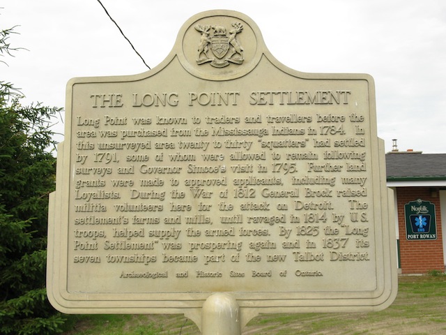
Photo by contributor Wayne Adam - Posted October, 2010
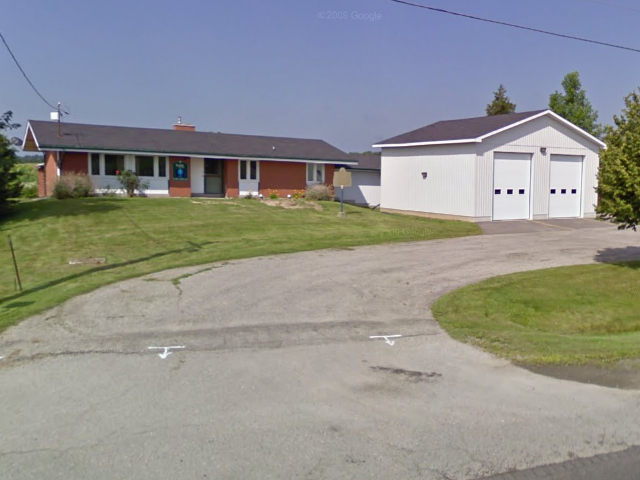
Photo from Google Street View ©2010 Google - Posted October, 2010
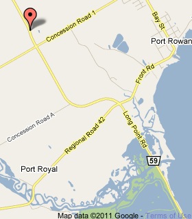
Plaque Location
The County of Norfolk
In front of the Norfolk County Port Rowan EMS building
1417 Road 59, 2.8 km north of Road 42
Coordinates: N 42 37.577 W 80 29.141 |
 |
Plaque Text
Long Point was known to traders and travellers before the area was purchased from the Mississauga Indians in 1784. In this unsurveyed area twenty to thirty "squatters" had settled by 1791, some of whom were allowed to remain following surveys and Governor Simcoe's visit in 1795. Further land grants were made to approved applicants, including many Loyalists. During the War of 1812 General Brock raised militia volunteers here for the attack on Detroit. The settlement's farms and mills, until ravaged in 1814 by U.S. troops, helped supply the armed forces. By 1825 the "Long point Settlement" was prospering again and in 1837 the seven townships became part of the new Talbot District.
Related Ontario plaques
John Graves Simcoe 1752-1806
United Empire Loyalists
Major-General Sir Isaac Brock, K.B., 1769-1812
The Capture of Detroit
More
Settlements
More
War of 1812
Here are the visitors' comments for this page.
(none yet)
Here's where you can write a comment for this page.
Note: If you wish to ask me a question, please use the email link in the menu.
Note: Comments are moderated. Yours will appear on this page within 24 hours
(usually much sooner).