Ontario's Provincial Plaques
Here's where you can learn a little Ontario history.
Founding of Port Hope
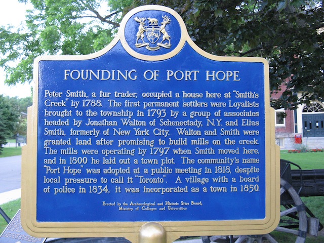
Photo by Alan L Brown - May 20, 2004
Plaque Location
The County of Northumberland
The Municipality of Port Hope
In front of the town hall on the NW corner of Queen Street and Dorset Street West
Plaque Text
Peter Smith, a fur trader, occupied a house here at "Smith's Creek" in 1788. The first permanent settlers were Loyalists brought to the Township in 1793 by a group of associates headed by Jonathan Walton of Schenectady, New York, and Elias Smith formerly of New York City. Walton and Smith were granted land after promising to build mills on the creek. The mills were operating by 1797 when Smith moved here, and in 1800 he laid out a town plot. The cemeteries name, "Port Hope" was adopted at a public meeting in 1818, despite local pressure to call it "Toronto". A village with a board of police in 1834, it was incorporated as a town in 1850.
Here's More
Information
Here's More
Settlements
Here are the comments for this page.
(none yet)
Write a comment for this page.
(Note: If you wish to ask me a question, please use the email link in the menu.)
Note: Comments are moderated. Yours will appear on this page within 24 hours (usually much sooner).