Here's where you can learn a little Ontario history
The Founding of Cobourg
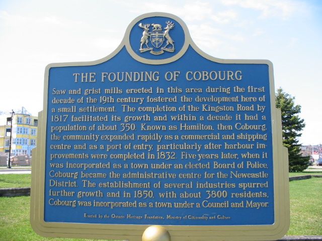
Photo by Alan L Brown - May, 2004
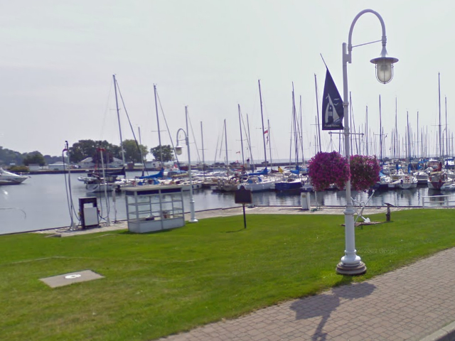
Photo from Google Street View ©2010 Google - November, 2010
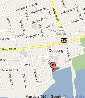
Plaque Location
The County of Northumberland
The Town of Cobourg
On the east side of 3 Street south of Albert Street
where it meets the water
near the south end of the Cobourg Marina
Coordinates: N 43 57.393 W 78 10.025 |
 |
Plaque Text
Saw and grist mills erected in this area during the first decade of the 19th century fostered the development here of a small settlement. The completion of the Kingston Road by 1817 facilitated its growth and within a decade it had a population of about 350. Known as Hamilton, then Cobourg, the community expanded rapidly as a commercial and shipping centre and as a port of entry, particularly after harbour improvements were completed in 1832. Five years later, when it was incorporated as a town under an elected Board of Police, Cobourg became the administrative centre for the Newcastle District. The establishment of several industries spurred further growth and in 1850, with about 3800 residents, Cobourg was incorporated as a town under a Council and Mayor.
More
Information
More
Settlements
Here are the comments for this page.
(none yet)
Here's where you can write a comment for this page.
Note: If you wish to ask me a question, please use the email link in the menu.
Note: Comments are moderated. Yours will appear on this page within 24 hours
(usually much sooner).