Here's where you can learn a little Ontario history
The Founding of Colborne
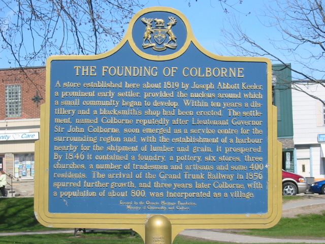
Photo by Alan L Brown - May, 2004
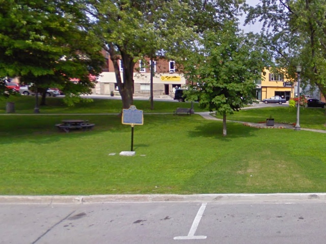
Photo from Google Street View ©2010 Google - October, 2010
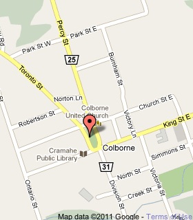
Plaque Location
The County of Northumberland
The Township of Cramahe
In Colborne, in a park on the east side of Toronto Street
just north of King street
Coordinates: N 44 00.328 W 77 53.324 |
 |
Plaque Text
A store established here about 1819 by Joseph Abbott Keeler, a prominent early settler, provided the nucleus around which a small community began to develop. Within ten years a distillery and a blacksmith's shop had been erected. The settlement, named Colborne reputedly after Lieutenant Governor Sir John Colborne, soon emerged as a service centre for the surrounding region and, with the establishment of a harbour nearby for the shipment of lumber and grain, it prospered. By 1846 it contained a foundry, a pottery, six stores, three churches, a number of tradesmen and artisans and some 400 residents. The arrival of the Grand Trunk Railway in 1856 spurred further growth and three years later Colborne, with a population of about 800, was incorporated as a village.
More
Information
More
Settlements
Here are the comments for this page.
(none yet)
Here's where you can write a comment for this page.
Note: If you wish to ask me a question, please use the email link in the menu.
Note: Comments are moderated. Yours will appear on this page within 24 hours
(usually much sooner).