Ontario's Historical Plaques
at ontarioplaques.com
Learn a little Ontario history as told through its plaques
The Liberation of the Netherlands
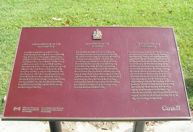
Photo by contributor Colin Old - Posted October, 2009
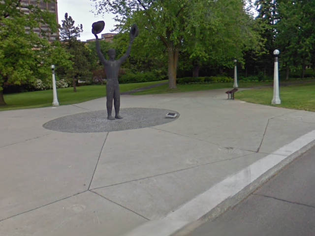
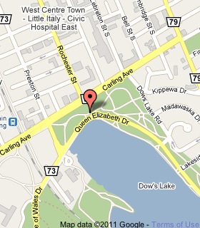
Photo from Google Street View ©2010 Google - Posted December, 2010
Plaque Location
The City of Ottawa
On the north side of Queen Elizabeth Drive
just east of Preston Street
Coordinates: N 45 23.874 W 75 42.312 |
 |
Plaque Text
Canada brought liberty and life to the Netherlands at the end of the Second World War. Between October 1944 and May 1945, with fierce fighting and heavy loss of life, the Canadian military opened the Scheldt estuary and the port of Antwerp to Allied supplies, cleared much of the country of the enemy, and fed a Dutch people left starving by the Nazi occupiers. On May 5, 1945, in Wageningen, the Germans surrendered to Canadian Lieutenant-General Charles Foulkes and H.R.H. Prince Bernhard of the Netherlands, commander of the Dutch armed forces. The bonds of friendship forged between Canada and the Netherlands stand strong to this day.
More
Information
More
Assorted Events
Here are the visitors' comments for this page.
(none yet)
Here's where you can write a comment for this page.
Note: If you wish to ask me a question, please use the email link in the menu.
Note: Comments are moderated. Yours will appear on this page within 24 hours
(usually much sooner).