Ontario's Historical Plaques
at ontarioplaques.com
Learn a little Ontario history as told through its plaques
Lake Nipissing
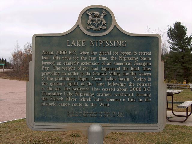
Photo by contributor Jamie Toeppner - Posted November, 2005
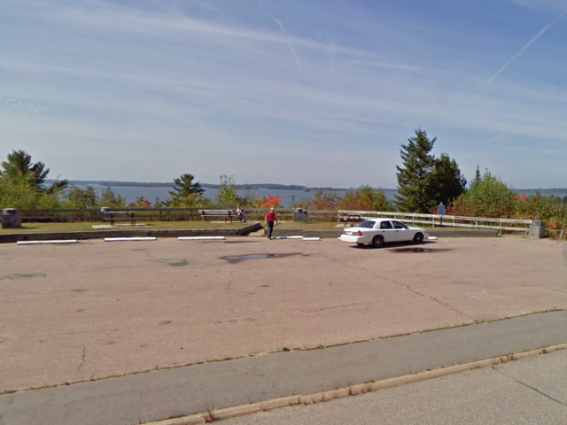
Photo from Google Street View ©2010 Google - Posted November, 2010
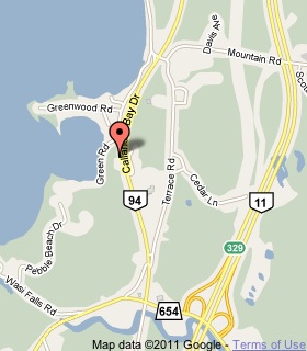
Plaque Location
The District of Parry Sound
The Municipality of Callander
At a parking lookout over the lake
on the west side of Callander Bay Drive
2.2 km south of the intersection of
Callander Bay Drive and Lansdowne Street
Coordinates: N 46 12.321 W 79 21.742 |
 |
Plaque Text
About 9000 B.C., when the glacial ice began to retreat from this area for the last time, the Nipissing basin formed an easterly extension of an ancestral Georgian Bay. The weight of ice had depressed the land, thus providing an outlet to the Ottawa Valley for the waters of the prehistoric Upper Great Lakes basin. Owing to the gradual uplift of the land following the retreat of the ice, the eastward flow ceased about 2000 B.C. Thereafter Lake Nipissing drained westward, forming the French River which later became a link in the historic canoe route to the West.
Related Ontario plaques
Canoe Route to the West
The Mattawa Route
More
Information
More
Lakes and Rivers
Here are the visitors' comments for this page.
(none yet)
Here's where you can write a comment for this page.
Note: If you wish to ask me a question, please use the email link in the menu.
Note: Comments are moderated. Yours will appear on this page within 24 hours
(usually much sooner).