Ontario's Historical Plaques
at ontarioplaques.com
Learn a little Ontario history as told through its plaques
The Rosseau-Nipissing Road
There are three plaques about this road.
All are in the District of Parry Sound
All can be seen on this page.
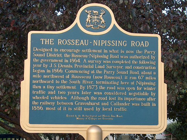
Photo by contributor Jamie Toeppner - Posted November, 2005
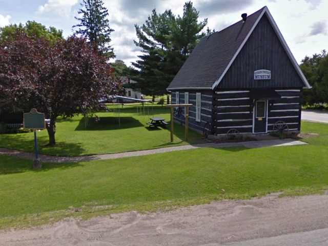
Photo from Google Street View ©2010 Google - Posted November, 2010
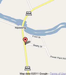
Plaque Location
The District of Parry Sound
The Township of Nipissing
In Nipissing, at the Nipissing Township Museum
on the northeast corner of Highway 654 and Beatty Street
Coordinates: N 46 05.711 W 79 30.871 |
 |
Plaque Text
Designed to encourage settlement in what is now the Parry Sound District, the Rosseau-Nipissing Road was authorized by the government in 1864. A survey was completed the following year by J.S. Dennis, Provincial Land Surveyor, and construction began in 1866. Commencing at the Parry Sound Road, about 1.6 km northwest of Rousseau (now Rosseau), it ran 108 km northward to the South River, terminating here at Nipissing then a tiny settlement. By 1873 the road was open for winter traffic and two years later was considered negotiable by wheeled vehicles. Although the road lost its importance after the railway between Gravenhurst and Callander was built in 1886, most of it is still used by local traffic.
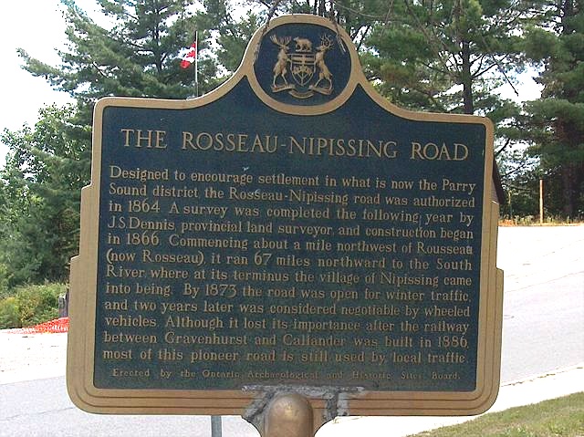
Photo by contributor Jamie Toeppner - Posted November, 2005
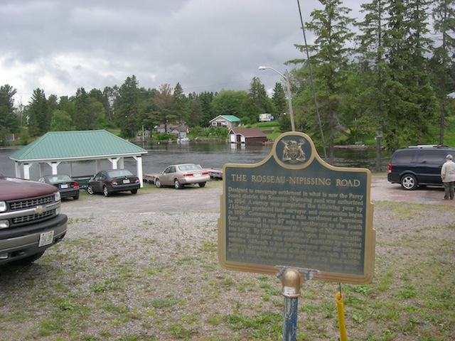
Photo by contributor Albert Joseph - Posted August, 2011
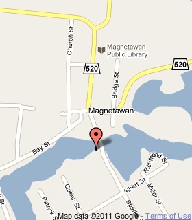
Plaque Location
The District of Parry Sound
The Municipality of Magnetawan
On Sparks Street, below the southwest corner of the bridge
over the river
Coordinates: N 45 39.810 W 79 38.606 |
 |
Plaque Text
Designed to encourage settlement in what is now the Parry Sound District, the Rosseau-Nipissing Road was authorized by the government in 1864. A survey was completed the following year by J.S. Dennis, provincial land surveyor, and construction began in 1866. Commencing about 1.6 km northwest of Rousseau (now Rosseau), it ran 108 km northward to the South River, where at its terminus the village of Nipissing came into being. By 1873 the road was open for winter traffic, and two years later was considered negotiable by wheeled vehicles. Although it lost its importance after the railway between Gravenhurst and Callander was built in 1886, most of this pioneer road is still used by local traffic.
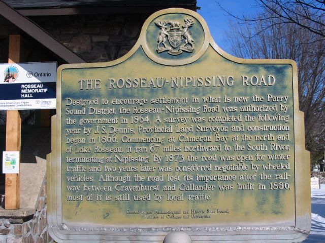
Photo by Alan L Brown - Posted March, 2006
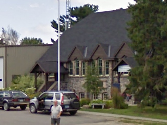
Photo from Google Street View ©2011 Google - Posted January, 2011
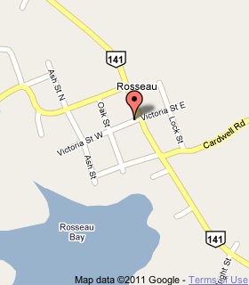
Plaque Location
The District of Parry Sound
The Township of Seguin
In Rosseau, in front of Rosseau Hall,
on Victoria Street just west of Highway 141
Coordinates: N 45 15.458 W 79 38.448 |
 |
Plaque Text
Designed to encourage settlement in what is now the Parry Sound District, the Rosseau-Nipissing Road was authorized by the government in 1864. A survey was completed the following year by J.S. Dennis, provincial land surveyor, and construction began in 1866. Commencing at Cameron Bay at the north end of Lake Rosseau, it ran 108 km northward to the South River terminating at Nipissing. By 1873 the road was open for winter traffic, and two years later was considered negotiable by wheeled vehicles. Although the road lost its importance after the railway between Gravenhurst and Callander was built in 1886, most of it is still used by local traffic.
More
Information
More
Roads
Here are the visitors' comments for this page.
(none yet)
Here's where you can write a comment for this page.
Note: If you wish to ask me a question, please use the email link in the menu.
Note: Comments are moderated. Yours will appear on this page within 24 hours
(usually much sooner).