Ontario's Historical Plaques
at ontarioplaques.com
Learn a little Ontario history as told through its plaques
The Government Inn 1798-1861
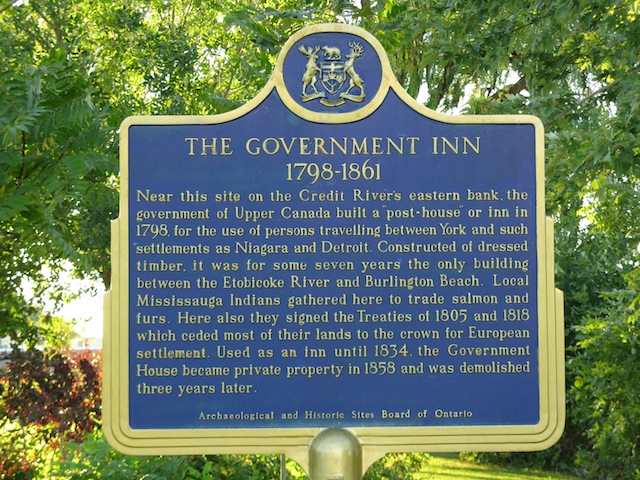
Photo by Alan L Brown - Posted April, 2004
Photo from Google Street View ©2011 Google - Posted January, 2011
Plaque Location
The Region of Peel
The City of Mississauga
In Port Credit, in Memorial Park on the east side of Front Street North
just north of Lakeshore Road West
on the west side of the Credit River bridge
Coordinates: N 43 33.026 W 79 35.251 |
Plaque Text
Near this site on the Credit River's eastern bank, the government of Upper Canada built a "post-house" or inn in 1798, for the use of persons travelling between York and such settlements as Niagara and Detroit. Constructed of dressed timber, it was for some seven years the only building between the Etobicoke River and Burlington Beach. Local Mississauga Indians gathered here to trade salmon and furs. Here also they signed the treaties of 1805 and 1818 which ceded most of their lands to the crown for European settlement. Used as an inn until 1834, the Government House became private property in 1858 and was demolished three years later.
More
Homes
Here are the visitors' comments for this page.
(none yet)
Here's where you can write a comment for this page.
Note: If you wish to ask me a question, please use the email link in the menu.
Note: Comments are moderated. Yours will appear on this page within 24 hours
(usually much sooner).