Ontario's Historical Plaques
at ontarioplaques.com
Learn a little Ontario history as told through its plaques
Streetsville
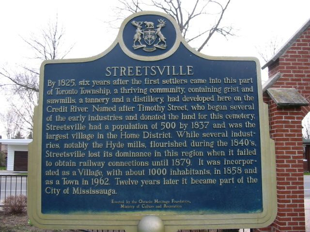
Photo by Alan L Brown - Posted April, 2004
Plaque Location
The Region of Peel
The City of Mississauga
In Streetsville, at the Memorial Cemetery beside a church
on the east side of Queen Street South
two blocks south of Thomas Street
Coordinates: N 43 34.714 W 79 42.558 |
Plaque Text
By 1825, six years after the first settlers came into this part of Toronto Township, a thriving community, containing grist and sawmills, a tannery and a distillery, had developed here on the Credit river. Named after Timothy Street, who began several of the early industries and donated the land for this cemetery, Streetsville had a population of 500 by 1837 and was the largest village in the Home District. While several industries, notably the Hyde mills, flourished during the 1840's, Streetsville lost its dominance in the region when it failed to obtain railway connections until 1879. It was incorporated as a Village, with about 1000 inhabitants, in 1858 and as a Town in 1962. Twelve years later it became part of the City of Mississauga.
More
Information
More
Settlements
Here are the visitors' comments for this page.
Posted June 12, 2009
As of June 2009, this plaque has been decapitated. Only the post remains. -Wayne
Here's where you can write a comment for this page.
Note: If you wish to ask me a question, please use the email link in the menu.
Note: Comments are moderated. Yours will appear on this page within 24 hours
(usually much sooner).