Ontario's Provincial Plaques
Here's where you can learn a little Ontario history.
The Founding of Renfrew
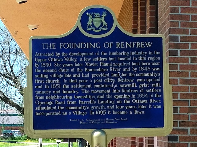
Photo by Alan L Brown - July 25, 2005
Plaque Location
The County of Renfrew
The Town of Renfrew
On the west side of Plaunt Street just north of Raglan Street South (Highway 60)
Plaque Text
Attracted by the development of the lumbering industry in the Upper Ottawa valley, a few settlers had located in this region by 1830. Six years later Xavier Plaunt acquired land here, near the second chute of the Bonnechere River and by 1848 was selling village lots and had provided land for the community's first church. In that year a post office, Renfrew, was opened and in 1851 the settlement contained a sawmill, grist-mill, tannery and foundry. The movement into Renfrew of settlers from neighbouring townships, and the opening in 1854 of the Opeongo Road from Farrell's Landing on the Ottawa River, stimulated the community's growth, and four years later it was incorporated as a Village. In 1895 it became a Town.
Here's More
Settlements
Here are the comments for this page.
(none yet)
Write a comment for this page.
(Note: If you wish to ask me a question, please use the email link in the menu.)
Note: Comments are moderated. Yours will appear on this page within 24 hours (usually much sooner).