Ontario's Historical Plaques
at ontarioplaques.com
Learn a little Ontario history as told through its plaques
The Founding of Midland
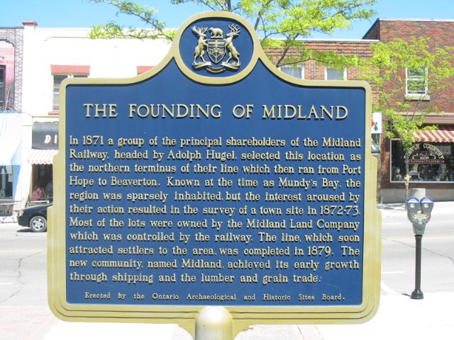
Photo by Alan L Brown - Posted June, 2004
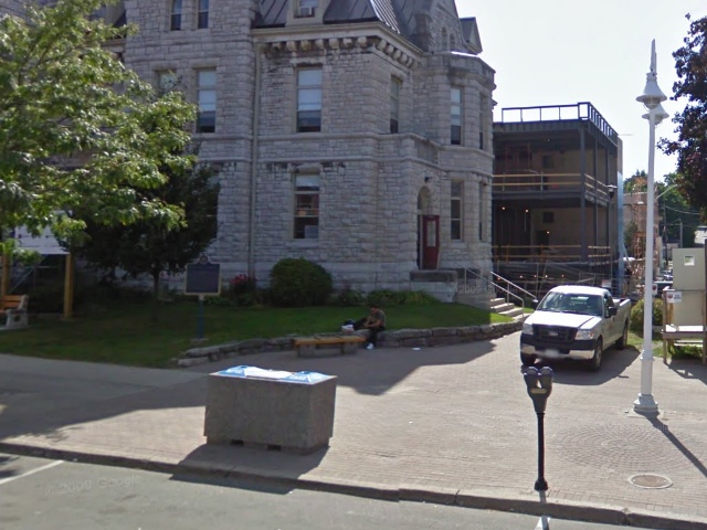
Photo from Google Street View ©2010 Google - Posted November, 2010
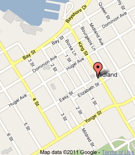
Plaque Location
The County of Simcoe
The Town of Midland
On King Street, 2.2 km north of Highway 12
in front of the library at King and Elizabeth Streets
Coordinates: N 44 44.918 W 79 53.075 |
 |
Plaque Text
In 1871 a group of the principal shareholders of the Midland Railway, headed by Adolph Hugel, selected this location as the northern terminus of their line which then ran from Port Hope to Beaverton. Known at the time as Mundy's Bay, the region was sparsely inhabited, but the interest aroused by their action resulted in the survey of a town site in 1872-73. Most of the lots were owned by the Midland Land Company which was controlled by the railway. The line, which soon attracted settlers to the area, was completed in 1879. The new community, named Midland, achieved its early growth through shipping and the lumber and grain trade.
More
Information
More
Settlements
Here are the visitors' comments for this page.
(none yet)
Here's where you can write a comment for this page.
Note: If you wish to ask me a question, please use the email link in the menu.
Note: Comments are moderated. Yours will appear on this page within 24 hours
(usually much sooner).