Ontario's Provincial Plaques
Here's where you can learn a little Ontario history.
The Huron Fish Weirs
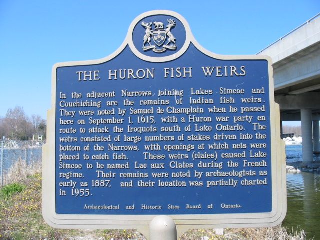
Photo by Alan L Brown - May 8, 2005
Plaque Location
The County of Simcoe
The Township of Ramara
At the Mnjikaning Fish Weirs National Historic Site of Canada, just south of the east end of the Atherley Narrows bridge
Plaque Text
In the adjacent Narrows joining Lakes Simcoe and Couchiching are the remains of Indian fish weirs. They were noted by Samuel de Champlain when he passed here on September 1, 1605, with a Huron war party en route to attack the Iroquois south of Lake Ontario. The weirs consisted of large numbers of stakes driven into the bottom of the Narrows, with openings at which nets were placed to catch fish. These weirs (claies) caused Lake Simcoe to be named Lac aux Claies during the French regime. Their remains were noted by archaeologists as early as 1887, and their location was partially charted in 1955.
Here's More
First Nations
Here are the comments for this page.
(none yet)
Write a comment for this page.
(Note: If you wish to ask me a question, please use the email link in the menu.)
Note: Comments are moderated. Yours will appear on this page within 24 hours (usually much sooner).