Ontario's Historical Plaques
at ontarioplaques.com
Learn a little Ontario history as told through its plaques
Cornwall Canal
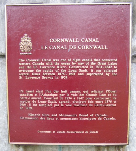
Photo by contributor Colin Old - Posted January, 2012
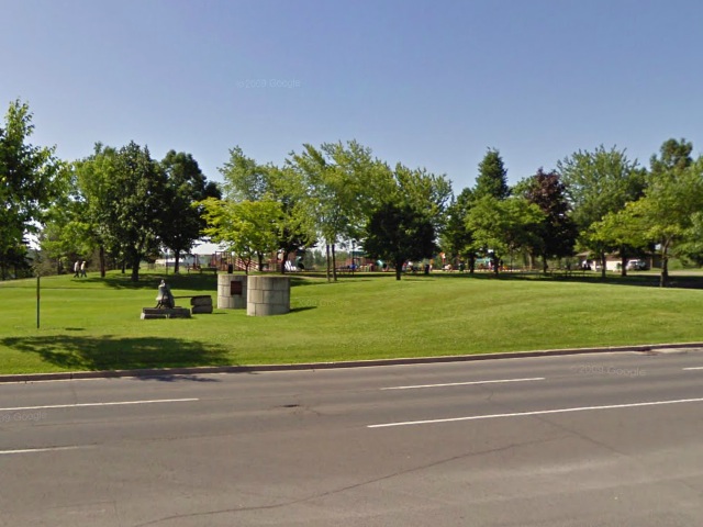
Photo from Google Street View ©2012 Google - Posted January, 2012
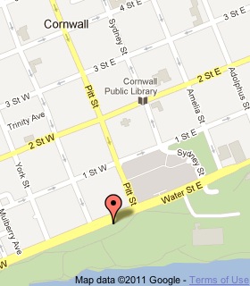
Plaque Location
The United Counties of Stormont, Dundas and Glengarry
The City of Cornwall
At Lock 20 in Lamoureux Park
on Water Street West just west of Pitt Street
Coordinates: N 45 00.881 W 074 43.686 |
 |
Plaque Text
The Cornwall Canal was one of eight canals that connected western Canada with the ocean by way of the Great Lakes and the St. Lawrence River. Constructed in 1834-1842 to overcome the rapids of the Long Sault, it was enlarged several times between 1876-1904 and superseded by the St. Lawrence Seaway in 1959.
Related Ontario plaque
The Construction of the St. Lawrence Seaway
More
Information
More
Canals
Here are the visitors' comments for this page.
(none yet)
Here's where you can write a comment for this page.
Note: If you wish to ask me a question, please use the email link in the menu.
Note: Comments are moderated. Yours will appear on this page within 24 hours
(usually much sooner).