Ontario's Historical Plaques
at ontarioplaques.com
Learn a little Ontario history as told through its plaques
The Founding of Sudbury
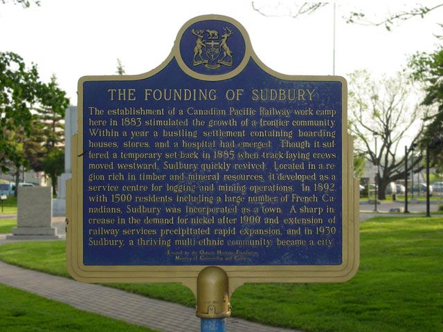
Photo by contributor Kal Biro - Posted June, 2004
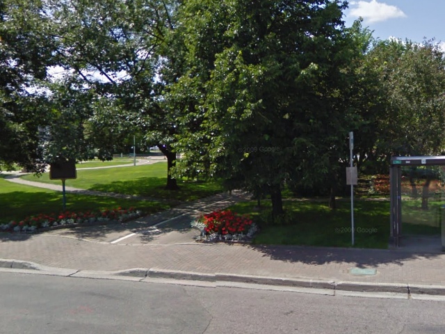
Photo from Google Street View ©2010 Google - Posted October, 2010
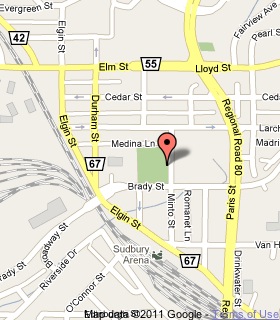
Plaque Location
The City of Greater Sudbury
In Memorial Park on Minto Street
between Bradley Street and Medina Lane
Coordinates: N 46 29.411 W 80 59.523 |
 |
Plaque Text
The establishment of a Canadian Pacific Railway work camp here in 1883 stimulated the growth of a frontier community. Within a year a bustling settlement containing boarding houses, stores, and a hospital had emerged. Though it suffered a temporary set-back in 1885 when track-laying crews moved westward, Sudbury quickly revived. Located in a region rich in timber and mineral resources, it developed as a service centre for logging and mining operations. In 1892, with 1500 residents including a large number of French Canadians, Sudbury was incorporated as a town. A sharp increase in the demand for nickel after 1900 and extension of railway services precipitated rapid expansion, and in 1930 Sudbury, a thriving multi-ethnic community, became a city.
More
Information
More
Settlements
Here are the visitors' comments for this page.
(none yet)
Here's where you can write a comment for this page.
Note: If you wish to ask me a question, please use the email link in the menu.
Note: Comments are moderated. Yours will appear on this page within 24 hours
(usually much sooner).
Note: As soon as the comment is posted, a link to it will appear on the home page in the section "Here are the 10 latest plaque pages with a new comment added by a visitor to this site."