Ontario's Historical Plaques
at ontarioplaques.com
Learn a little Ontario history as told through its plaques
Salter's Meridian 1856
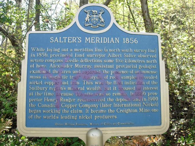
Photo by contributor Mona Albano - Posted October, 2005
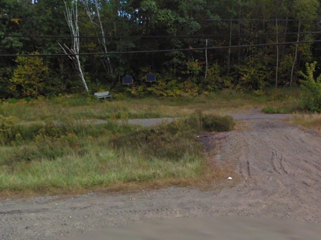
Photo from Google Street View ©2011 Google - Posted January, 2011
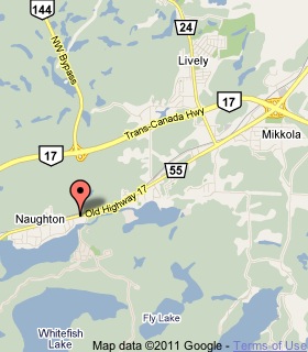
Plaque Location
The City of Greater Sudbury
In Naughton, on the south side of Road 55
between Reserve Road and Simon Lake Drive
5.4 km west of the intersection of Road 55 with Highway 17
Coordinates: N 46 24.252 W 81 10.926 |
 |
Plaque Text
While laying out a meridian line (a north-south survey line) in 1856, provincial land surveyor Albert Salter observed severe compass needle deflections some five kilometres north of here. Alexander Murray, assistant provincial geologist, examined the area and reported "the presence of an immense mass of magnetic trap". Analysis of rock samples revealed nickel, copper and iron. This was the first indications of the Sudbury region's mineral wealth, but it aroused no interest at the time because the site was so remote. In 1886 prospector Henry Ranger rediscovered the deposit and in 1900 the Canadian Copper Company (later International Nickel) began working the claim. It became the Creighton Mine, one of the world's leading nickel producers.
Related Ontario plaques
Niven's Meridian
The Sudbury Basin
Discovery of the Sudbury Nickel Deposits
More
Information
More
Mining
Here are the visitors' comments for this page.
Posted July 28, 2011
This plaque has now been replaced, no more grafitti
Here's where you can write a comment for this page.
Note: If you wish to ask me a question, please use the email link in the menu.
Note: Comments are moderated. Yours will appear on this page within 24 hours
(usually much sooner).
Note: As soon as the comment is posted, a link to it will appear on the home page in the section "Here are the 10 latest plaque pages with a new comment added by a visitor to this site."