Ontario's Historical Plaques
at ontarioplaques.com
Learn a little Ontario history as told through its plaques
The Pic
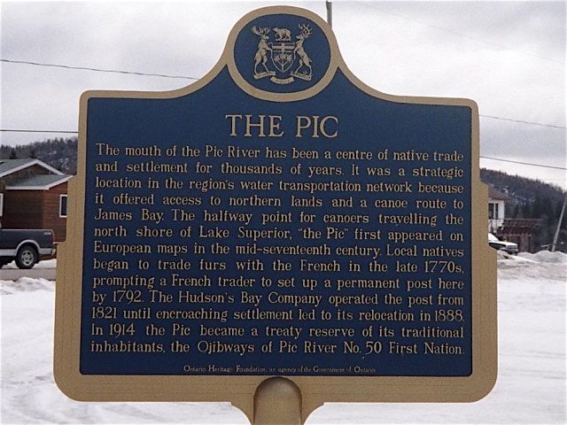
Photo by contributor Thomas William Kirkbride - Posted June, 2006
Plaque Location
The District of Thunder Bay
The Town of Marathon
Near St. Xavier Church, off Park Road, Pic River First Nation
Coordinates: (unknown) |
Plaque Text
The mouth of the Pic River has been the centre of native trade and settlement for thousands of years. It was a strategic location in the region's water transportation network because it offered access to northern lands and a canoe route to James Bay. The halfway point for canoers travelling the north shore of lake Superior, "the Pic" first appeared on European maps in the mid-seventeenth century. Local natives began to trade furs with the French in the late 1770s, prompting a French trader to set up a post here by 1792. The Hudson's Bay Company operated the post from 1821 until encroaching settlement led to its relocation in 1888. In 1914 the Pic became a treaty reserve of its traditional inhabitants, the Ojibways of Pic River No. 50 First Nation.
More
Trading Posts
Here are the visitors' comments for this page.
(none yet)
Here's where you can write a comment for this page.
Note: If you wish to ask me a question, please use the email link in the menu.
Note: Comments are moderated. Yours will appear on this page within 24 hours
(usually much sooner).