Ontario's Historical Plaques
at ontarioplaques.com
Learn a little Ontario history as told through its plaques
Oliver Daunais 1836-1916
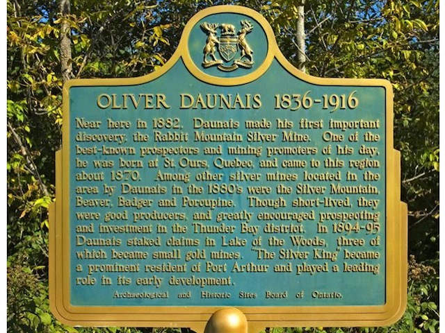
Photo by contributor Dave Fernie - Posted September, 2005
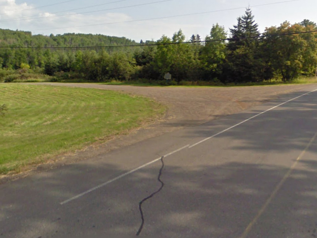
Photo from Google Street View ©2010 Google - Posted October, 2010
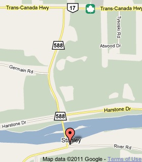
Plaque Location
The District of Thunder Bay
The Municipality of Oliver Paipoonge
West of Thunder Bay, on the northeast corner of
Highway 588 and River Road about 2 km south of Highway 11/17
just over the Kaministiquia River bridge
Coordinates: N 48 21.911 W 89 34.039 |
 |
Plaque Text
Near here in 1882, Daunais made his first important discovery, the Rabbit Mountain Silver Mine. One of the best-known prospectors and mining promoters of his day, he was born at St. Ours, Quebec, and came to this region about 1870. Among other silver mines located in the area by Daunais in the 1880's were the Silver Mountain, Beaver, Badger and Porcupine. Though short-lived, they were good producers, and greatly encouraged prospecting and investment in the Thunder Bay district. In 1894-95 Daunais staked claims in Lake of the Woods, three of which became small gold mines. "The Silver King" became a prominent resident of Port Arthur and played a leading role in its early development.
Related Ontario plaques
Silver Islet 1868
Silver Mining in Canada
Cobalt Mining Camp
Cobalt Mining
More
Information
More
Mining
Here are the visitors' comments for this page.
Posted March 22, 2012
Hi, This Olivier Donais was my Great grandfathers brother. His name was Jean Baptiste. I am trying to find my great grandfather/grandmother., Jean Baptiste Daunais'was born abt 1834-35. I want to find out my Ojibwe roots. LDS site states J. Baptiste Daunais father was Olivier and Mother UNKNOWN. Ojibwe connaction?? I remember my father telling me that my Great Grandmother was a Tchiatan, and had a WICKED temper!!
Thanks in advance, Dennis Donais Southbridge, MASS
Posted March 22, 2012
I am also related to Oliver Daunais. He is the brother of my great-great grandfather, Joseph Daunais, b. Apr 15, 1820.
Posted November 23, 2011
Oliver was my grandmothers brother . her married name was giroux husband juliess my fathers name was martin hank
Here's where you can write a comment for this page.
Note: If you wish to ask me a question, please use the email link in the menu.
Note: Comments are moderated. Yours will appear on this page within 24 hours
(usually much sooner).