Ontario's Historical Plaques
at ontarioplaques.com
Learn a little Ontario history as told through its plaques
Glacial Terraces
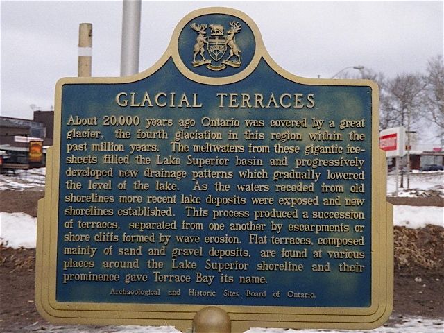
Photo by contributor Thomas William Kirkbride - Posted June, 2006
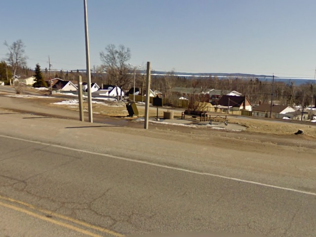
Photo from Google Street View ©2011 Google - Posted March, 2011 - with thanks to contributor Wayne Adam
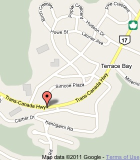
Plaque Location
The District of Thunder Bay
The Township of Terrace Bay
In Terrace Bay, on the south side of Highway 17
across from Simcoe Plaza
1.0 km east of the Aguasabon River bridge
Coordinates: N 48 46.895 W 87 06.134 |
 |
Plaque Text
About 20,000 years ago Ontario was covered by a great glacier, the fourth glaciation in this region within the past million years. The meltwaters from these gigantic ice-sheets filled the Lake Superior basin and progressively developed new drainage patterns which gradually lowered the level of the lake. As the waters receded from old shorelines more recent lake deposits where exposed and new shorelines established. This process produced a succession of terraces, separated from one another by escarpments or shore cliffs formed by wave erosion. Flat terraces, composed mainly of sand and gravel deposits, are found at various places around the Lake Superior shoreline and their prominence gave Terrace Bay its name.
More
Information
More
Landforms
Here are the visitors' comments for this page.
(none yet)
Here's where you can write a comment for this page.
Note: If you wish to ask me a question, please use the email link in the menu.
Note: Comments are moderated. Yours will appear on this page within 24 hours
(usually much sooner).