Ontario's Historical Plaques
at ontarioplaques.com
Learn a little Ontario history as told through its plaques
The Pigeon River Road
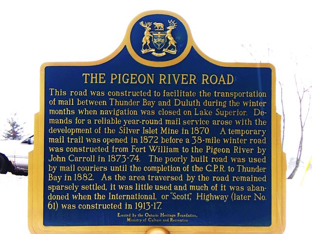
Photo by contributor Thomas William Kirkbride - Posted March, 2006
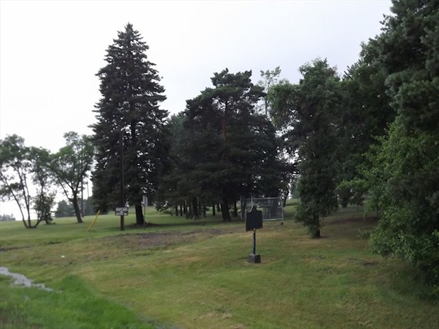
Photo by contributors Peter and Gloria - Posted July, 2012
Plaque Location
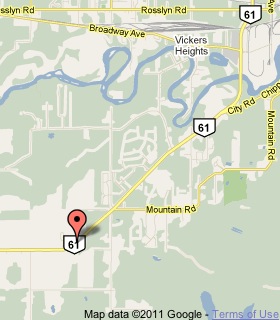
The District of Thunder Bay
The City of Thunder Bay
On Highway 61, 6 km west of the Kaministiquia River Bridge
Coordinates: N 48 18.550 W 89 22.382 |
 |
Plaque Text
This road was constructed to facilitate the transportation of mail between Thunder Bay and Duluth during the winter months when navigation was closed on Lake Superior. Demands for a reliable year-round mail service arose with the development of the Silver Islet Mine in 1870. A temporary mail trail was opened in 1872 before a 61 km winter road was constructed from Fort William to the Pigeon River by John Carroll in 1873-74. The poorly built road was used by mail carriers until the completion of the C.P.R. to Thunder Bay in 1882. As the area traversed by the road remained sparsely settled, it was little used and much of it was abandoned when the International, or "Scott", Highway (later No. 61) was constructed in 1913-17.
Related Ontario plaque
Silver Islet 1868
More
Roads
Here are the visitors' comments for this page.
(none yet)
Here's where you can write a comment for this page.
Note: If you wish to ask me a question, please use the email link in the menu.
Note: Comments are moderated. Yours will appear on this page within 24 hours
(usually much sooner).
Note: As soon as the comment is posted, a link to it will appear on the home page in the section "Here are the 10 latest plaque pages with a new comment added by a visitor to this site."