Here's where you can learn a little Ontario history
The Founding of Harriston
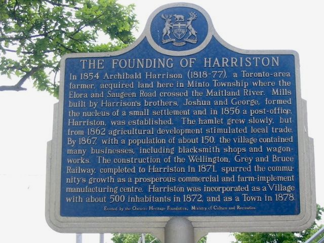
Photo by contributor David Brown - June, 2004
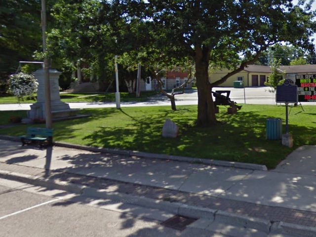
Photo from Google Street View ©2011 Google - April, 2011
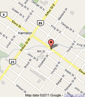
Plaque Location
The County of Wellington
The Town of Minto
In Harriston, on the northwest corner of
Elora Street East and Mill Street
Coordinates: N 43 54.715 W 80 52.143 |
 |
Plaque Text
In 1854 Archibald Harrison (1818-77), a Toronto-area farmer, acquired land here in Minto Township where the Elora and Saugeen Road crossed the Maitland River. Mills built by Harrison's brothers, Joshua and George, formed a nucleus of a small settlement and in 1856 a small post-office, Harriston, was established. The hamlet grew slowly, but from 1862 agricultural development stimulated local trade. By about 1867, with a population of about 150, the village contained many businesses, including blacksmith shops and wagonworks. The construction of the Wellington, Grey and Bruce Railway, completed to Harriston in 1871, spurred the community's growth as a prosperous commercial and farm-implement manufacturing centre. Harriston was incorporated as a Village with about 500 inhabitants in 1872 and as a Town in 1878.
More
Information
More
Settlements
Here are the comments for this page.
(none yet)
Here's where you can write a comment for this page.
Note: If you wish to ask me a question, please use the email link in the menu.
Note: Comments are moderated. Yours will appear on this page within 24 hours
(usually much sooner).