Ontario's Historical Plaques
at ontarioplaques.com
Learn a little Ontario history as told through its plaques
Yonge Street
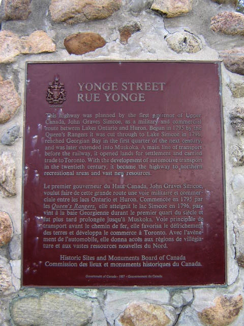
Photo by Alan L Brown - Posted May, 2009
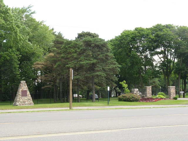
Photo by contributor Wayne Adam - Posted September, 2011
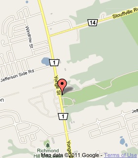
Plaque Location
The Region of York
The Town of Richmond Hill
On the east side of Yonge Street, south of Jefferson Sideroad,
at the entrance to the Summit Golf and Country Club
Coordinates: N 43 55.123 W 79 26.889 |
 |
Plaque Text
This highway was planned by the first governor of Upper Canada, John Graves Simcoe, as a military and commercial route between Lakes Ontario and Huron. Begun in 1795 by the Queen's Rangers it was cut through to Lake Simcoe in 1796, reached Georgian Bay in the first quarter of the next century, and was later extended into Muskoka. A main line of transport before the railway, it opened lands for settlement and carried trade to Toronto. With the development of automotive transport in the twentieth century, it became the highway to northern recreational areas and vast new resources.
Related Ontario plaque
John Graves Simcoe 1752-1806
Related Toronto plaques
Yonge Street 1796
The Queen's Rangers
More
Information
More
Roads
Here are the visitors' comments for this page.
(none yet)
Here's where you can write a comment for this page.
Note: If you wish to ask me a question, please use the email link in the menu.
Note: Comments are moderated. Yours will appear on this page within 24 hours
(usually much sooner).
Note: As soon as the comment is posted, a link to it will appear on the home page in the section "Here are the 10 latest plaque pages with a new comment added by a visitor to this site."
* Temporary Note: Due to my absence from my computer on August 24, 25 and 26, 2012, all comments sent on those days will not be posted until the 27th.