Ontario's Historical Plaques
at ontarioplaques.com
Learn a little Ontario history as told through its plaques
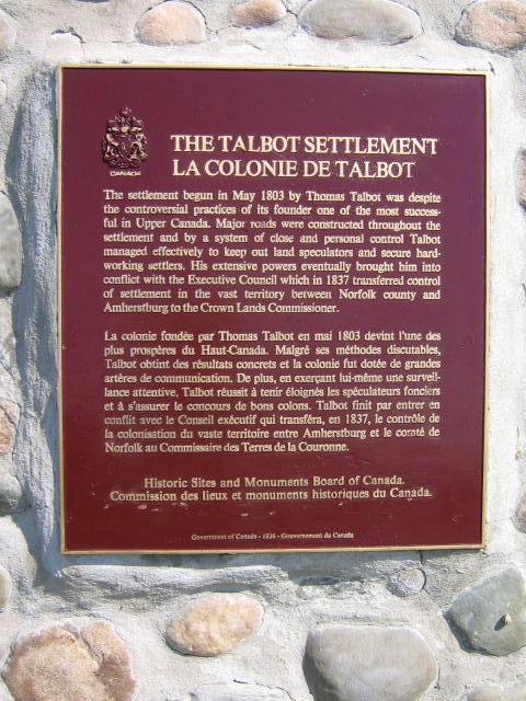
The Talbot Settlement
Photos by Alan L Brown - Posted June, 2009
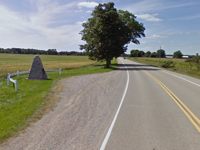
Photo from Google Street View ©2011 Google - Posted February, 2011
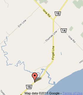
Plaque Location
The County of Elgin
The Municipality of Dutton Dunwich
On a pull-off on the south side of Fingal Line (Road 16)
3.3 km west of Iona Road (Road 14)
Coordinates: N 42 38.403 W 81 21.969 |
 |
Plaque Text
The settlement begun in May 1803 by Thomas Talbot was despite the controversial practices of its founder one of the most successful in Upper Canada. Major roads were constructed throughout the settlement and by a system of close and personal control Talbot managed effectively to keep out land speculators and secure hard-working settlers. His extensive powers eventually brought him into conflict with the Executive Council which in 1837 transferred control of settlement in the vast territory between Norfolk county and Amherstburg to the Crown Lands Commissioner.
Related Ontario plaques
Colonel The Honourable Thomas Talbot 1771-1853
The Talbot Road
More
Information
More
Settlements
Here are the visitors' comments for this page.
(none yet)
Here's where you can write a comment for this page.
Note: If you wish to ask me a question, please use the email link in the menu.
Note: Comments are moderated. Yours will appear on this page within 24 hours
(usually much sooner).