Here's where you can learn a little Ontario history
The Trent-Severn Waterway
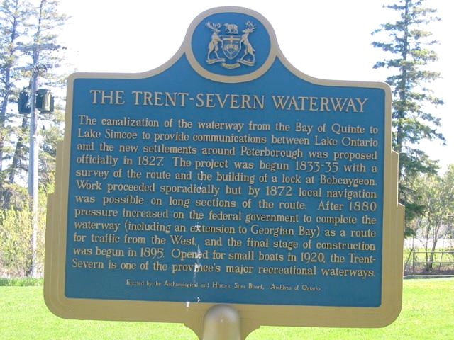
Photo by Alan L Brown - May, 2004
Photo from Google Street View ©2010 Google - December, 2010
Plaque Location
The City of Kawartha Lakes
In Kirkfield, at the south end of the Lift Lock parking lot
on the west side of Road 6, just north of the lock
N 44 35.416 W 78 59.412
Plaque Text
The canalization of the waterway from the Bay of Quinte to Lake Simcoe to provide communications between Lake Ontario and the new settlements around Peterborough was proposed officially in 1827. The project was begun 1833-35 with a survey of the route and the building of a lock at Bobcaygeon. Work proceeded sporadically but by 1872 local navigation was possible on long sections of the route. After 1880 pressure increased on the federal government to complete the waterway (including an extension to Georgian Bay) as a route for traffic from the West, and the final stage of construction was begun in 1895. Opened for small boats in 1920, the Trent-Severn is one of the province's major recreational waterways.
Related Ontario plaque pages
Trent Canal
Peterborough Lift Lock
Scugog Route
Canal Lake Arch Bridge
More
Information
More
Waterways
Here are the comments for this page.
(none yet)
Here's where you can write a comment for this page.
Note: If you wish to ask me a question, please use the email link in the menu.
Note: Comments are moderated. Yours will appear on this page within 24 hours
(usually much sooner).