Ontario's Historical Plaques
at ontarioplaques.com
Learn a little Ontario history as told through its plaques
The Founding of Chesley
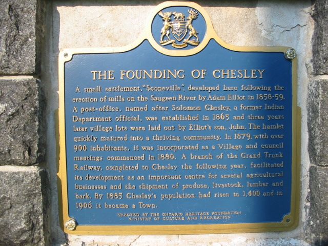
Photo by Alan L Brown - Posted June, 2005
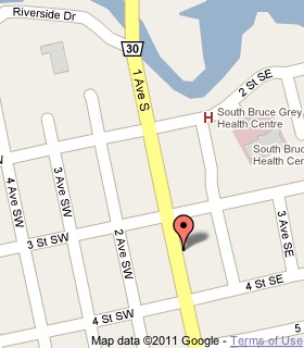
Plaque Location
The County of Bruce
The Municipality of Arran-Elderslie
In Chesley, on a wall on the east side of
1st Avenue South (Road 30) between
3rd Street SW and 4th Street SW
Coordinates: N 44 17.822 W 81 05.685 |
 |
Plaque Text
A small settlement, "Sconeville", developed here following the erection of mills on the Saugeen River by Adam Elliot in 1858-59. A post-office, named after Solomon Chesley, a former Indian Department official, was established in 1865 and three years later village lots were laid out by Elliot's son, John. The hamlet quickly matured into a thriving community. In 1879, with over 900 inhabitants, it was incorporated as a Village and council meetings commenced in 1880. A branch of the Grand Trunk Railway, completed to Chesley the following year, facilitated its development as an important centre for several agricultural businesses and the shipment of produce, livestock, lumber and bark. By 1885, Chesley's population had risen to 1,400 and in 1906 it became a Town.
More
Information
More
Settlements
Here are the visitors' comments for this page.
(none yet)
Here's where you can write a comment for this page.
Note: If you wish to ask me a question, please use the email link in the menu.
Note: Comments are moderated. Yours will appear on this page within 24 hours
(usually much sooner).
Note: As soon as the comment is posted, a link to it will appear on the home page in the section "Here are the 10 latest plaque pages with a new comment added by a visitor to this site."