Ontario's Historical Plaques
at ontarioplaques.com
Learn a little Ontario history as told through its plaques
The Development of Pelee Island
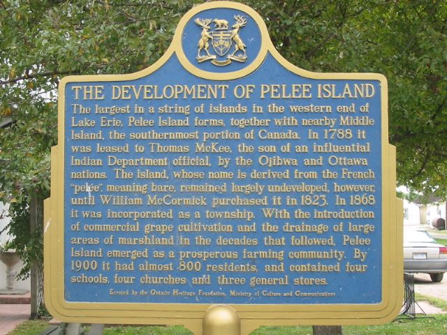
Photo by Alan L Brown - Posted September, 2004
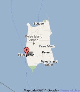
Plaque Location
The County of Essex
The Township of Pelee
One Pelee Island, in front of a museum across from the West Dock
Coordinates: N 41 45.362 W 82 41.277 |
 |
Plaque Text
The largest in a string of islands in the western end of Lake Erie, Pelee Island forms, together with nearby Middle Island, the southernmost portion of Canada. In 1788 it was leased to Thomas McKee, the son of an influential Indian Department official, by the Ojibwa and Ottawa nations. The island, whose name is derived from the French "pelée", meaning bare, remained largely undeveloped, however, until William McCormick purchased it in 1823. In 1868 it was incorporated as a township. With the introduction of commercial grape cultivation and the drainage of large hectares of marshland in the decades that followed, Pelee Island emerged as a prosperous farming community. By 1900 it had almost 800 residents, and contained four schools, four churches and three general stores.
More
Information
More
Settlements
Here are the visitors' comments for this page.
(none yet)
Here's where you can write a comment for this page.
Note: If you wish to ask me a question, please use the email link in the menu.
Note: Comments are moderated. Yours will appear on this page within 24 hours
(usually much sooner).