Here's where you can learn a little Ontario history
Founding of Durham
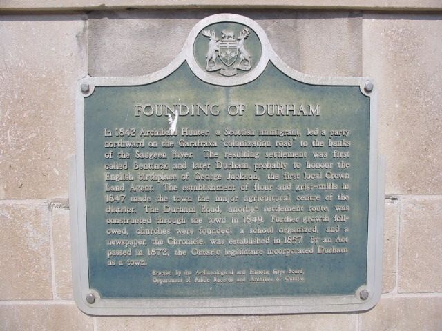
Photo by Alan L Brown - June, 2005
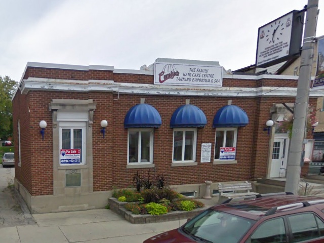
Photo from Google Street View ©2011 Google - February, 2011
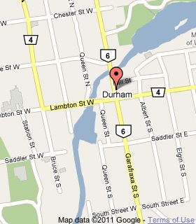
Plaque Location
The County of Grey
The Township of West Grey
In Durham, on the wall of the second building
on the east side of Garafraxa Street north of Lambton Street
Coordinates: N 44 10.602 W 80 49.112 |
 |
Plaque Text
In 1842 Archibald Hunter, a Scottish immigrant, led a party northward on the Garafraxa "colonization road" to the banks of the Saugeen River. The resulting settlement was first called Bentinck and later Durham, probably to honour the English birthplace of George Jackson, the first local Crown Land Agent. The establishment of flour and grist-mills in 1847 made the town the major agricultural centre of the district. The Durham Road, another settlement route , was constructed through the town in 1849. Further growth followed, churches were founded, a school organized, and a newspaper, the Chronicle, was established in 1857. By an Act passed in 1872, the Ontario legislature incorporated Durham as a town.
More
Information
More
Settlements
Here are the comments for this page.
(none yet)
Here's where you can write a comment for this page.
Note: If you wish to ask me a question, please use the email link in the menu.
Note: Comments are moderated. Yours will appear on this page within 24 hours
(usually much sooner).