Ontario's Historical Plaques
at ontarioplaques.com
Learn a little Ontario history as told through its plaques
Bobcaygeon Road
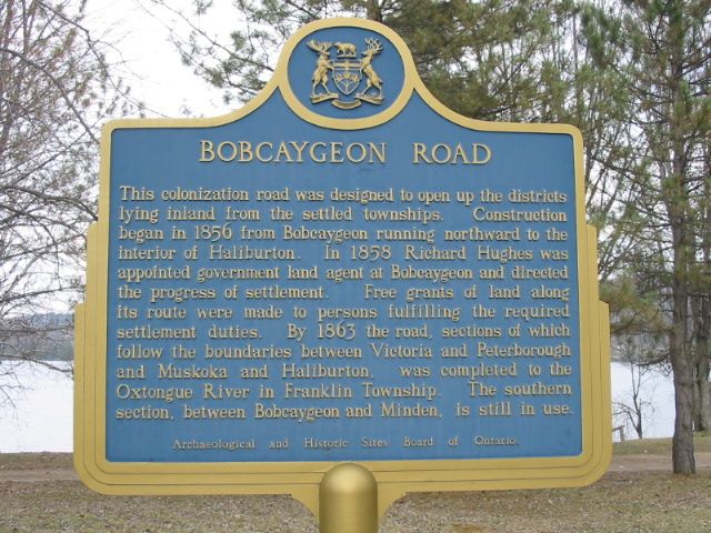
Photo by Alan L Brown - Posted May, 2005
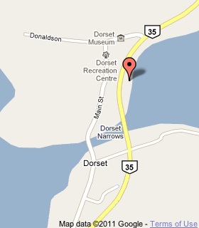
Plaque Location
The County of Haliburton
Township of Algonquin Highlands
In Dorset, in a picnic area on the east side of Highway 35
north of Highway 117 just north of the Lake of Bays bridge
at street number 22602
Coordinates: N 45 14.872 W 78 53.513 |
 |
Plaque Text
This colonization road was designed to open up the districts lying inland from the settled townships. Construction began in 1856 from Bobcaygeon running northward to the interior of Haliburton. In 1858 Richard Hughes was appointed government land agent at Bobcaygeon and directed the progress of settlement. Free grants of land along its route were made to persons fulfilling the required settlement duties. By 1863 the road, sections of which follow the boundaries between Victoria and Peterborough and Muskoka and Haliburton, was completed to the Oxtongue River in Franklin Township. The southern section, between Bobcaygeon and Minden, is still in use.
More
Information
More
Roads
Here are the visitors' comments for this page.
Posted March 23, 2009
Are there maps that show the northern section of the Bobcageon Road as it was and the settlements located on it ?
Russ
Here's where you can write a comment for this page.
Note: If you wish to ask me a question, please use the email link in the menu.
Note: Comments are moderated. Yours will appear on this page within 24 hours
(usually much sooner).
Note: As soon as the comment is posted, a link to it will appear on the home page in the section "Here are the 10 latest plaque pages with a new comment added by a visitor to this site."
* Temporary Note: Due to my absence from my computer on August 24, 25 and 26, 2012, all comments sent on those days will not be posted until the 27th.