Ontario's Historical Plaques
at ontarioplaques.com
Learn a little Ontario history as told through its plaques
The Perth Road
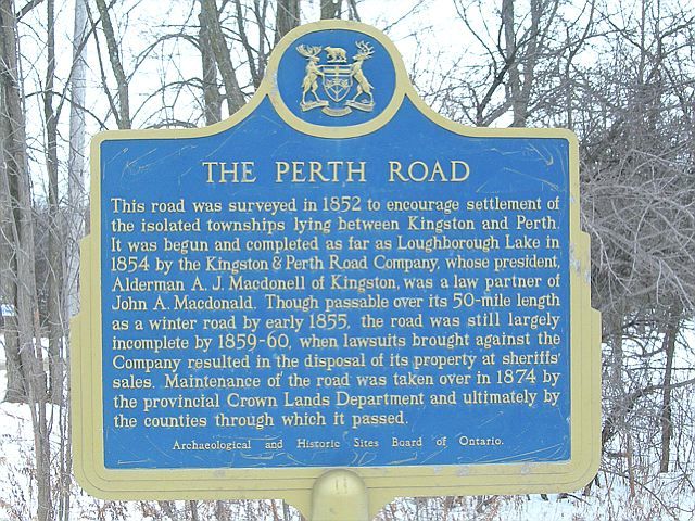
Photo by contributor Belinda Betz - Posted January, 2006
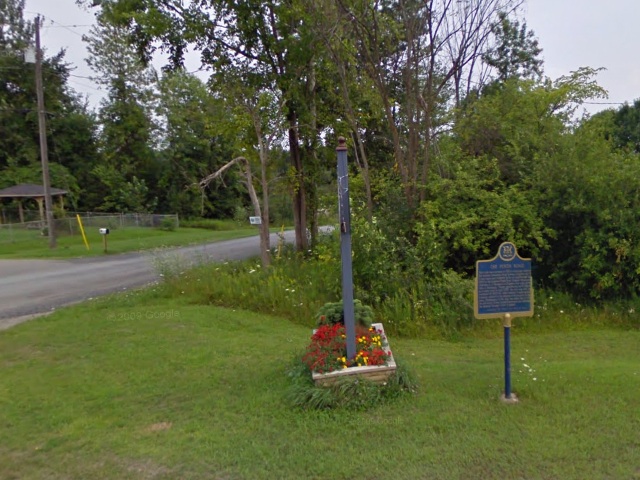
Photo from Google Street View ©2010 Google - Posted December, 2010
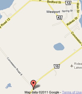
Plaque Location
The United Counties of Leeds & Grenville
The Village of Westport
About 1.5 km south of Westport on Road 10
at the intersection with 8th Concession Road
Coordinates: N 44 39.698 W 76 24.480 |
 |
Plaque Text
This road was surveyed in 1852 to encourage settlement of the isolated townships lying between Kingston and Perth. It was begun and completed as far as Loughborough Lake in 1854 by the Kingston & Perth Road Company, whose president, Alderman A.J. Macdonell of Kingston, was a law partner of John A. Macdonald. Though passable over its 80 km length as a winter road by early 1855, the road was still largely incomplete by 1859-60, when lawsuits brought against the Company resulted in the disposal of its property at sheriffs' sales. Maintenance of the road was taken over in 1874 by the provincial Crown Lands Department and ultimately by the counties through which it passed.
More
Roads
Here are the visitors' comments for this page.
(none yet)
Here's where you can write a comment for this page.
Note: If you wish to ask me a question, please use the email link in the menu.
Note: Comments are moderated. Yours will appear on this page within 24 hours
(usually much sooner).
Note: As soon as the comment is posted, a link to it will appear on the home page in the section "Here are the 10 latest plaque pages with a new comment added by a visitor to this site."