Ontario's Historical Plaques
at ontarioplaques.com
Learn a little Ontario history as told through its plaques
Long Point Portage
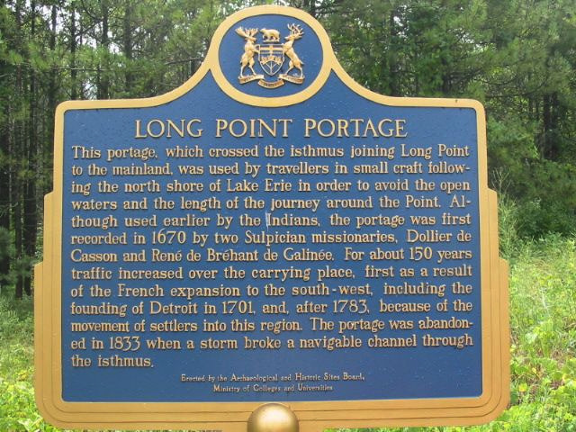
Photo by Alan L Brown - Posted August, 2004
Photo from Google Street View ©2010 Google - Posted October, 2010
Plaque Location
The County of Norfolk
At the end of Road 59 just before the entrance to Long Point Park
at a pullover on the west side of the road just past Bluebill Avenue
Coordinates: N 42 34.863 W 80 23.726 |
Plaque Text
This portage, which crossed the isthmus joining Long Point to the mainland, was used by travelers in small craft following the north shore of Lake Erie in order to avoid the open waters and the length of the journey around the Point. Although used earlier by the Indians, the portage was first recorded in 1670 by two Sulpician missionaries, Dollier de Casson and René de Bréhant de Galinée. For about 150 years traffic increased over the carrying place, first as a result of the French expansion to the southwest, including the founding of Detroit in 1701, and, after 1783, because of the movement of settlers into this region. The portage was abandoned in 1833 when a storm broke a navigable channel through the isthmus.
Related Ontario plaques
The Heroine of Long Point
The Long Point Settlement
More
Portages
Here are the visitors' comments for this page.
(none yet)
Here's where you can write a comment for this page.
Note: If you wish to ask me a question, please use the email link in the menu.
Note: Comments are moderated. Yours will appear on this page within 24 hours
(usually much sooner).