Ontario's Historical Plaques
at ontarioplaques.com
Learn a little Ontario history as told through its plaques
Penetanguishene Road 1814

Photo by Alan L Brown - Posted May, 2005
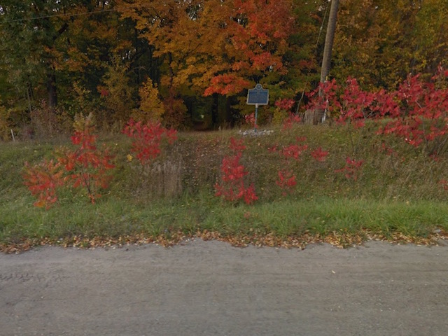
Photo from Google Street View ©2010 Google - Posted November, 2010
Plaque Location
The County of Simcoe
The Town of Midland
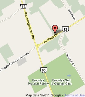
On the north side of Heritage Drive (Highway 12)
.5 km east of Highway 93
Coordinates: N 44 43.267 W 79 53.553 |
 |
Plaque Text
The course of this road from Kempenfeldt Bay to the site of Penetanguishene was first surveyed by Samuel Wilmot in 1811. Dr. William (Tiger) Dunlop supervised its construction in the fall of 1814 and, although frequently impassible for heavy loads, it served for many years as a supply route to the garrison at Penetanguishene. Under a system of free grants, most of the land immediately adjacent to the road was settled 1819-1830.
Related Ontario plaques
Penetanguishene
Tiger Dunlop 1792-1848
More
Information
More
Roads
Here are the visitors' comments for this page.
(none yet)
Here's where you can write a comment for this page.
Note: If you wish to ask me a question, please use the email link in the menu.
Note: Comments are moderated. Yours will appear on this page within 24 hours
(usually much sooner).
Note: As soon as the comment is posted, a link to it will appear on the home page in the section "Here are the 10 latest plaque pages with a new comment added by a visitor to this site."
* Temporary Note: Due to my absence from my computer on August 24, 25 and 26, 2012, all comments sent on those days will not be posted until the 27th.