Ontario's Historical Plaques
at ontarioplaques.com
Learn a little Ontario history as told through its plaques
The Robinson Superior Treaty
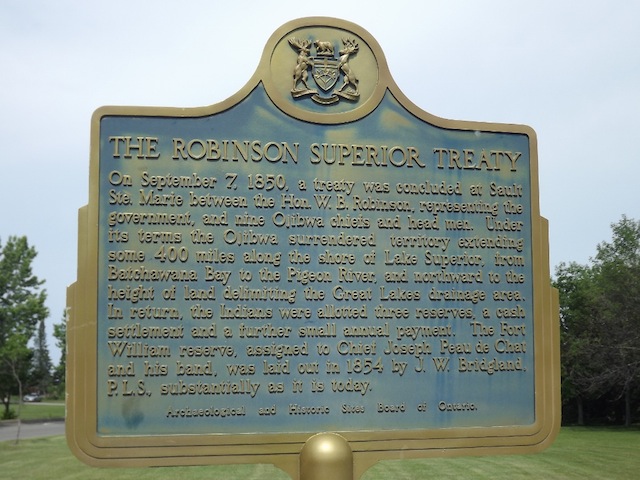
Photo by contributor Thomas William Kirkbride - Posted March, 2006
Plaque Location
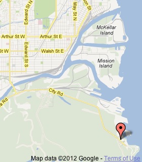
The District of Thunder Bay
The City of Thunder Bay
In Chippewa Park, at the east end of City Road
10.3 km from Highway 61
Coordinates: (unknown) |
 |
Plaque Text
On September 7, 1850, a treaty was concluded at Sault Ste. Marie between the Hon. W.B. Robinson, representing the government, and nine Ojibwa chiefs and head men. Under its terms the Ojibwa surrendered territory extending some 640 km along the shore of Lake Superior, from Batchawana Bay to the Pigeon River, and northward to the height of land delimiting the Great Lakes drainage area. In return, the Indians were allotted three reserves, a cash settlement and a further small annual payment. The Fort William reserve, assigned to Chief Joseph Peau de Chat and his band, was laid out in 1854 by J.W. Bridgland, P.L.S., substantially as it is today.
Related Ontario plaque
Manitoulin Treaties 1836 and 1862
More
Information
More
First Nations
Here are the visitors' comments for this page.
Posted June 5, 2010
The traditional first nations people of this country are it's only hope. Please help mother earth. Please remember your ancestry and teach the "whites" how to live in harmony with the earth and how not to destroy her. She needs your help.
Tara Outhouse
(Irish, Dutch, English, Scottish ancestry but a true Indian in my heart)
Here's where you can write a comment for this page.
Note: If you wish to ask me a question, please use the email link in the menu.
Note: Comments are moderated. Yours will appear on this page within 24 hours
(usually much sooner).