Ontario's Historical Plaques
at ontarioplaques.com
Learn a little Ontario history as told through its plaques
Simon James Dawson 1820-1902
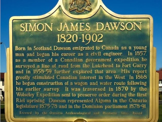
Photo by contributor Dave Fernie - Posted October, 2005
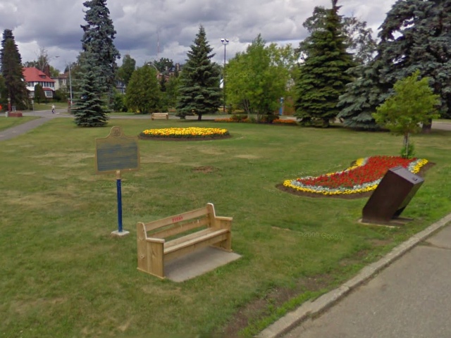
Photo from Google Street View ©2010 Google - Posted October, 2010
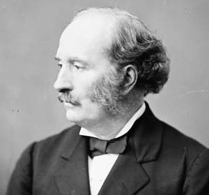
Photo Source - Wikipedia
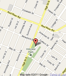
Plaque Location
The District of Thunder Bay
The City of Thunder Bay
Beside the parking lot on Colonel Keene Drive in Hillcrest Park
on High Street South, just south of Red River Road
Coordinates: N 48 26.131 W 89 14.030 |
 |
Plaque Text
Born in Scotland, Dawson emigrated to Canada as a young man and began his career as a civil engineer. In 1857 as a member of a Canadian government expedition, he surveyed a line of road from the Lakehead to Fort Garry and in 1858-59 further explored that area. His report greatly stimulated Canadian interest in the West. In 1868 he began construction of a wagon and water route following his earlier survey. It was traversed in 1870 by the Wolseley Expedition sent to preserve order during the first Riel uprising. Dawson represented Algoma in the Ontario legislature 1875-78 and in the Dominion parliament 1878-91.
Related Ontario plaque
The French Portage
The Wolseley Expedition 1870
More
Information
More
Surveyors
Here are the visitors' comments for this page.
Posted November 13, 2011
I came across this site while doing research for my book. It is unfortunate that there is so much we don't know outside the generalities of mainstream Canadian history unless we just happen across it. This is an informative site as are most of those regarding such plaques.
Here's where you can write a comment for this page.
Note: If you wish to ask me a question, please use the email link in the menu.
Note: Comments are moderated. Yours will appear on this page within 24 hours
(usually much sooner).