Here's where you can learn a little Ontario history
Arctic Watershed
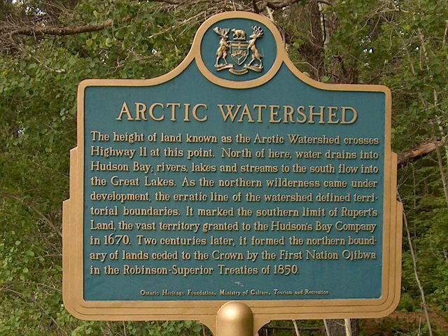
Photo by contributor Jamie Toeppner - November, 2005
Plaque Location
In the District of Timiskaming
On Highway 11 where the watershed crosses the highway, about 20 km north of Highway 66 at coordinates N 48 13.047 W 80 15.413.
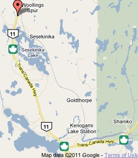
Click here for an interactive map. © 2009 Microsoft
Plaque Text
The height of land known as the Arctic Watershed crosses Highway 11 at this point. North of here, water drains into Hudson Bay; rivers, lakes and streams to the south flow into the Great Lakes. As the northern wilderness came under development, the erratic line of the watershed defined territorial boundaries. It marked the southern limit of Rupert's Land, the vast territory granted to the Hudson's Bay Company in 1670. Two centuries later, it formed the northern boundary of lands ceded to the Crown by the First Nation Ojibwa in the Robinson-Superior Treaties of 1850.
Related Ontario plaque pages
Robinson Superior Treaty
The Arctic Watershed
More
Information
More
Waterways
Here are the comments for this page.
(none yet)
Here's where you can write a comment for this page.
Note: If you wish to ask me a question, please use the email link in the menu.
Note: Comments are moderated. Yours will appear on this page within 24 hours
(usually much sooner).