Ontario's Historical Plaques
at ontarioplaques.com
Learn a little Ontario history as told through its plaques
Early Settlement in Erin Township
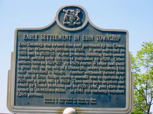
Photo by Alan L Brown - Posted June, 2004
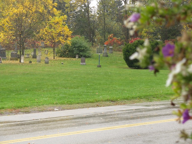
Photo by contributor Wayne Adam - Posted November, 2011
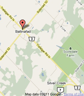
Plaque Location
The County of Wellington
The Town of Erin
In Ballinafad, in a cemetery on the northwest corner of
Trafalgar Road North and Sideroad 32
3.7 km north of Highway 7
Coordinates: N 43 41.768 W 80 00.759 |
 |
Plaque Text
Erin Township was formed from land purchased by the Crown from the Mississauga Indians in 1818. It was surveyed in 1818 and in 1820-21. A few grantees, including three named Roszel, settled near the site of Ballinafad by 1820. Other settlers came in 1821-27. By 1828 Aaron Wheller had built a grist mill on the site of Hillsburgh, where Nazareth Hill later established a village. Another settlement formed near the site of Erin village where a sawmill was in operation by 1828 and a grist mill by 1829. These mills were acquired and rebuilt by Daniel McMillan and in 1839 "Erin" post office was opened at "McMillan's Mills". In 1841 the township contained 1,368 persons.
More
Information
More
Settlements
Here are the visitors' comments for this page.
Posted November 10, 2011
Scotsdale Farm, which appears on the location map for this plaque, is a nearby property of the Ontario Heritage Trust--the agency which erects these provincial plaques. Entry to the grounds is free, with historic buildings offering insights into 19th and 20th century farming. Trails, including the Bruce Trail, cross this Niagara Escarpment park. -Wayne
Here's where you can write a comment for this page.
Note: If you wish to ask me a question, please use the email link in the menu.
Note: Comments are moderated. Yours will appear on this page within 24 hours
(usually much sooner).