Ontario's Historical Plaques
at ontarioplaques.com
Learn a little Ontario history as told through its plaques
The Lawson Site
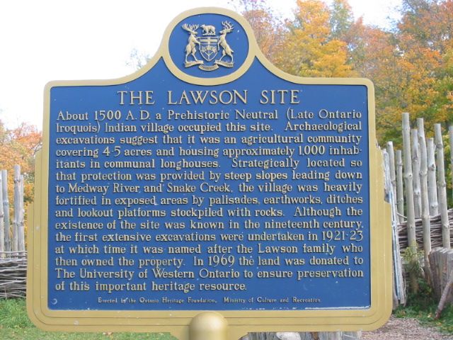
Photo by Alan L Brown - Posted November, 2004
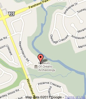
Plaque Location
The County of Middlesex
The City of London
At the museum at the south end of Attawandaron Road
east of Wonderland Road, south of Fanshawe Park Road West
Coordinates: N 43 00.827 W 81 18.311 |
 |
Plaque Text
About 1500 A.D. a Prehistoric Neutral (Late Ontario Iroquois) Indian village occupied this site. Archaeological excavations suggest that it was an agricultural community covering 1.5-2 ha and housing approximately 1,000 inhabitants in communal longhouses. Strategically located so that protection was provided by steep slopes leading down to Medway River and Snake Creek, the village was heavily fortified in exposed areas by palisades, earthworks, ditches and lookout platforms stockpiled with rocks. Although the existence of the site was known in the nineteenth century, the first extensive excavations were undertaken in 1921-23 at which time it was named after the Lawson family who then owned the property. In 1969 this land was donated to the University of Western Ontario to ensure preservation of this important heritage resource.
Related Ontario plaques
Credit Indian Village
Crawford Lake Indian Village Site
Newash Indian Village
The Nodwell Indian Village Site
Roebuck Indian Village Site
More
Information
More
First Nations
Here are the visitors' comments for this page.
(none yet)
Here's where you can write a comment for this page.
Note: If you wish to ask me a question, please use the email link in the menu.
Note: Comments are moderated. Yours will appear on this page within 24 hours
(usually much sooner).