Ontario's Historical Plaques
at ontarioplaques.com
Learn a little Ontario history as told through its plaques
The Founding of Chippawa
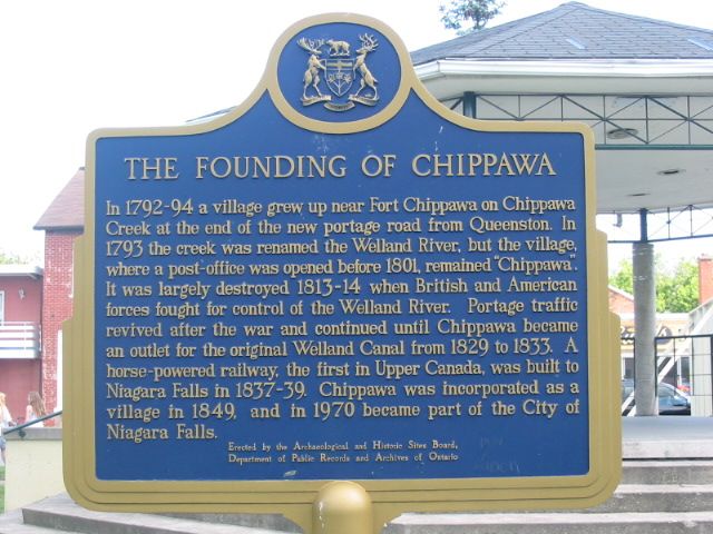
Photo by Alan L Brown - Posted August, 2004
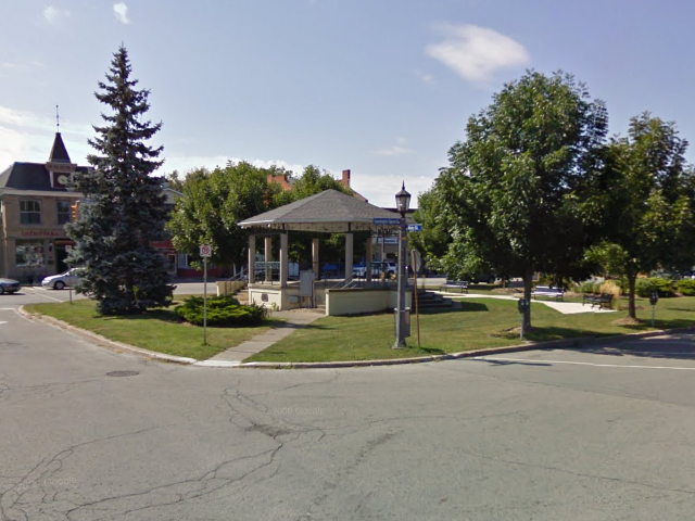
Photo from Google Street View ©2010 Google - Posted December, 2010
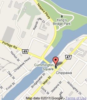
Plaque Location
The Region of Niagara
The City of Niagara Falls
In Chippawa, in the square at the south end
of the bridge over the Welland River
Coordinates: N 43 03.553 W 79 03.055 |
 |
Plaque Text
In 1792-94 a village grew up near Fort Chippawa on Chippawa Creek at the end of the new portage road from Queenston. In 1793 the creek was renamed the Welland River, but the village, where a post-office was opened before 1801, remained "Chippawa". It was largely destroyed 1813-14 when British and American forces fought for control of the Welland River. Portage traffic revived after the war and continued until Chippawa became an outlet for the original Welland Canal from 1829 to 1833. A horse-powered railway, the first in Upper Canada, was built to Niagara Falls in 1837-39. Chippawa was incorporated as a village in 1849, and in 1970 became part of the City of Niagara Falls.
Related Ontario plaques
Fort Chippawa, 1791
The Battle of Chippawa
More
Settlements
More
War of 1812
Here are the visitors' comments for this page.
(none yet)
Here's where you can write a comment for this page.
Note: If you wish to ask me a question, please use the email link in the menu.
Note: Comments are moderated. Yours will appear on this page within 24 hours
(usually much sooner).
Note: As soon as the comment is posted, a link to it will appear on the home page in the section "Here are the 10 latest plaque pages with a new comment added by a visitor to this site."