Here's where you can learn a little Ontario history
Fort Frances Canal 1878
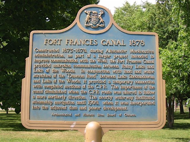
Photo by Alan L Brown - July, 2006
Plaque Location
The District of Rainy River
The Town of Fort Frances
In a park at 3rd Street West and Lillie Avenue near the water's edge.
Look for the green arrow on the interactive map below.
Latitude and Longitude Coordinates
48.610317 -93.410783
Plaque Text
Constructed 1875-78, during Alexander MacKenzie's administration as part of a larger project intended to improve communications with the West, the Fort Frances Canal provided unbroken communication between Rainy Lake and Lake of the Woods. In conjunction with land and water stretches of the 'Dawson Road' between Lake Shebandowan and Lake of the Woods, it provided temporary connection with completed sections of the C.P.R. The importance of the canal diminished when the C.P.R. route was altered to follow a more northerly direction. The nearby waterway facilitated steamship navigation until 1908, when it was incorporated into the adjacent dam and power development.
Here are related pages
Burlington Bay Canal
Desjardins Canal
First Welland Canal
Rideau Canal
Trent Canal
Williamsburg Canals
Magnetawan Lock
Here's more
Information
Here's more pages about
Waterways
Here are the comments for this page.
(none yet)
Here's where you can write a comment for this page.
Note: If you wish to ask me a question, please use the email link in the menu.
Note: Comments are moderated. Yours will appear on this page within 24 hours
(usually much sooner).