Ontario's Historical Plaques
at ontarioplaques.com
Learn a little Ontario history as told through its plaques
Nine Mile Portage
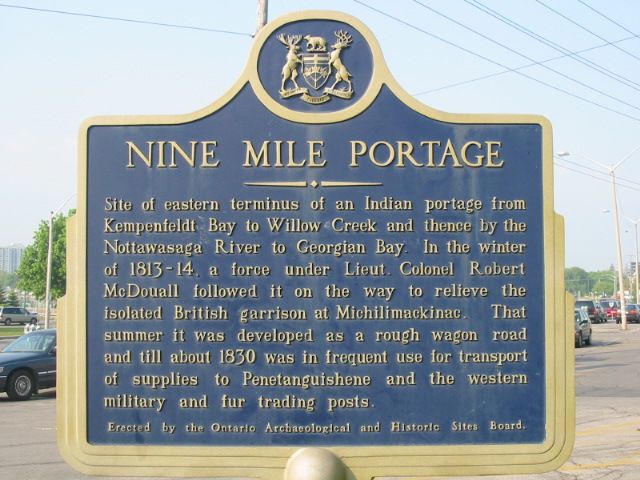
Photo by Alan L Brown - Posted June, 2004
Photo by contributor Wayne Adam - Posted September, 2012
Plaque Location
The County of Simcoe
The City of Barrie
In the southwest corner of the small park
on the south side of Dunlop Street East across from Owen Street
Coordinates: N 44 23.333 W 79 41.279 |
|
Plaque Text
Site of eastern terminus of an Indian portage from Kempenfeldt Bay to Willow Creek and thence by the Nottawasaga River to Georgian Bay. In the winter of 1813-14, a force under Lieut-Colonel Robert McDouall followed it on the way to relieve the isolated British garrison at Michilimackinac. That summer it was developed as a rough wagon road and till about 1830 was in frequent use for transport of supplies to Penetanguishene and the western military and fur trading posts.
Related Ontario plaques
Willow Creek Depot
Glengarry Landing
More
Portages
More
War of 1812
Here are the visitors' comments for this page.
(none yet)
Here's where you can write a comment for this page.
Note: If you wish to ask me a question, please use the email link in the menu.
Note: Comments are moderated. Yours will appear on this page within 24 hours
(usually much sooner).
Note: As soon as the comment is posted, a link to it will appear on the home page in the section "Here are the 10 latest plaque pages with a new comment added by a visitor to this site."