Ontario's Historical Plaques
at ontarioplaques.com
Learn a little Ontario history as told through its plaques
Glengarry Landing
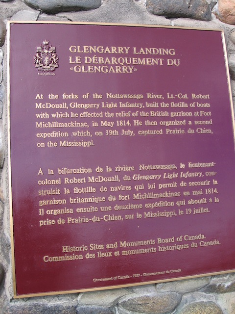
Photo by contributor Wayne Adam - Posted January, 2010
Photo from Google Street View ©2010 Google - Posted December, 2010
Plaque Location
The County of Simcoe
The Township of Springwater
17 km east of Staynor on Highway 26
at the entrance to Edenvale Conservation Area
near where the Nottawasaga River crosses the highway
Coordinates: N 44 27.051 W 79 54.071 |
Plaque Text
At the forks of the Nottawasaga River, Lt.-Col. Robert McDouall, Glengarry Light Infantry, built the flotilla of boats with which he effected the relief of the British garrison at Fort Michilimackinac, in May 1814. He then organized a second expedition which, on 19th July, captured Prairie du Chien, on the Mississippi.
Related Ontario plaques
Willow Creek Depot
Nine Mile Portage
More
Information
More
War of 1812
Here are the visitors' comments for this page.
(none yet)
Here's where you can write a comment for this page.
Note: If you wish to ask me a question, please use the email link in the menu.
Note: Comments are moderated. Yours will appear on this page within 24 hours
(usually much sooner).
Note: As soon as the comment is posted, a link to it will appear on the home page in the section "Here are the 10 latest plaque pages with a new comment added by a visitor to this site."