Ontario's Provincial Plaques
Here's where you can learn a little Ontario history.
Niven's Meridian
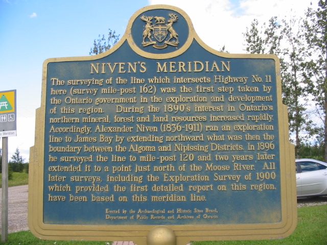
Photo by Alan L Brown - July 29, 2006
Plaque Location
The District of Cochrane
The Town of Cochrane
On Highway 11, in a park on the south side, about 3 km west of Cochrane
Plaque Text
The surveying of the line which intersects Highway No. 11 here (survey mile-post 162) was the first step taken by the Ontario government in the exploration and development of this region. During the 1890's interest in Ontario's northern mineral, forest and land resources increased rapidly. Accordingly, Alexander Niven (1836-1911) ran an exploration line to James Bay by extending northward what was then the boundary between the Algoma and Nipissing Districts. In 1896 he surveyed the line to mile-post 120 and two years later extended it to a point just north of the Moose River. All later surveys, including the Exploration Survey of 1900 which provided the first detailed report on this region, have been based on this meridian line.
Here's More
Information
Related pages:
Forty-Ninth Parallel
International Boundary
Ontario Boundary Dispute
Here are the comments for this page.
(none yet)
Write a comment for this page.
(Note: If you wish to ask me a question, please use the email link in the menu.)
Note: Comments are moderated. Yours will appear on this page within 24 hours (usually much sooner).